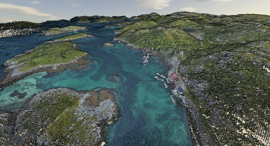
The world as seen by birds and fish: Helligvær and Bliksvær are mapped above and under water
Seamless topographic and bathymetric elevation models have been established using airborne bathymetric lidar over the two archipelagos Bliksvær and Helligvær in Northern Norway. With 13km2 of shallow water covered per flight hour, the efficiency of this technology is impressive.
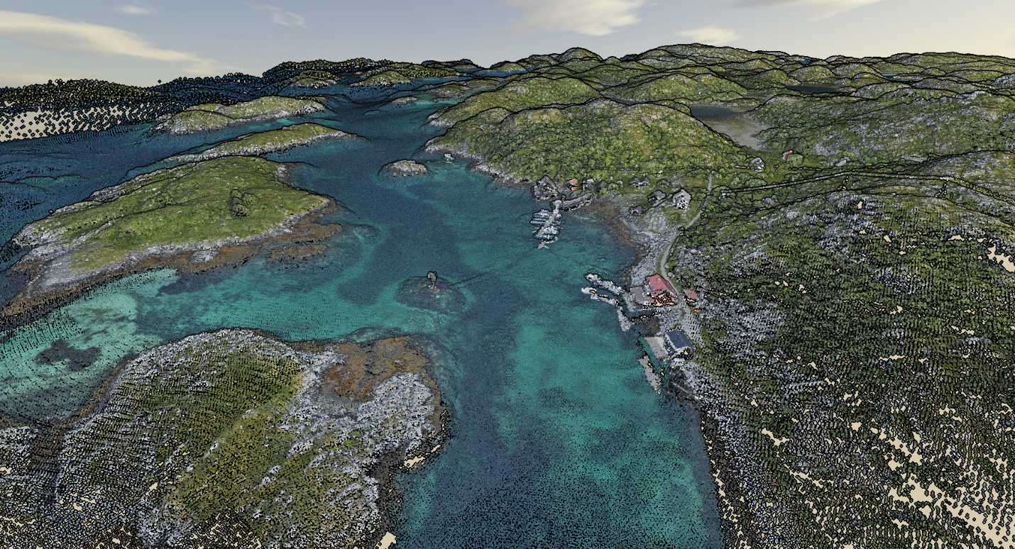
It has been more than a hundred years since the water depths in these areas were surveyed. As part of the Norwegian National Detailed Elevation Model project, Field has used its new and advanced CZMIL SuperNova bathymetric LiDAR sensor to succesfully complete this assignment for the Norwegian Mapping Authority (Kartverket).
The same sensor has been used earlier to survey the shallow sea areas around Stavanger as part of the Marine Basemaps in the coastal zone project.
Simultaneous mapping of land and sea
Usually, the land area is laser scanned with an aircraft (topographic mapping) - but the sea area is not included in the survey.
‘Can we combine mapping of land area and shallow sea areas? We have tested whether airborne laser technology for bathymetric surveying (using a green laser) also meets the requirements for land mapping. As a valuable first result, we have now created a seamless terrain model of Helligvær and Bliksvær’, says Christian Malmquist from the Norwegian Mapping Authority.
Further analysis of the data remains to be done before the Norwegian Mapping Authority can conclude whether the new mapping method with the airborne green laser satisfies the requirements for land mapping as well.
New opportunities
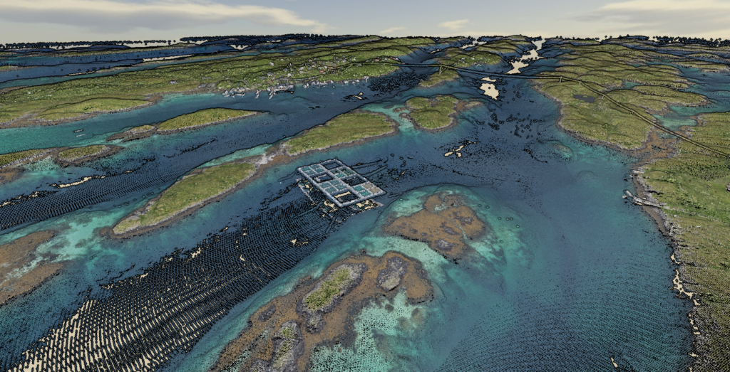
If the same mapping technology can be used on land and sea, this will potentially open up possibilities for:
- Streamlining the establishment of basic models for infrastructure in the coastal zone, e.g. planning and documentation of cables and pipes, harbours and activities within aquaculture.
- Providing a better basis for landslide modeling and danger zone maps for quick clay landslides.
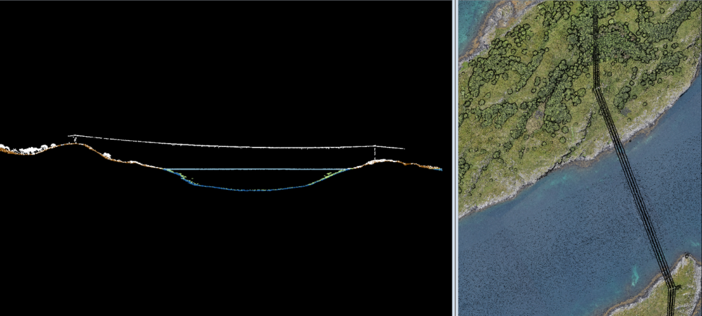
The sensor technology's ability to detect power cables above ground has also been assessed, in order to look at opportunities to streamline reporting for the national register of aviation obstacles.
In the picture below it is for example shown that the CZMIL SuperNova sensor can measure underwater depths, topographical elevations, and overhead power lines.
Data available at høydedata.no
Two data sets have been published on høydedata.no:
- The Helligvær and Bliksvær archipelagos off Bodø in Norway. Data has been collected as part of the project National Detailed Elevation Model.
- The islands of Klosterøy and Fjøløy north of Stavanger in Norway. Data has been collected as part of the auspices of the pilot project Marine Basemaps in the coastal zone.
While Field has used the same CZMIL SuperNova sensor in both projects, the goals for the mapping were somewhat different:
‘In Stavanger, the motivation was to obtain the best possible result for bathymetric mapping and to survey as deep as possible into the sea. For Bliksvær and Helligvær we wanted to assess the sensor's suitability for topographical mapping on land’, says Malmquist.
This article was originally published in Norwegian by the Norwegian Mapping Authorities in September 2022.
Insights
Related articles
A Day in the Field: Charles de Jongh
New office for Field: Carl Holen embarks on a month-long trek home to Ålesund
A Day in the Field: Tobias Jokisch
See all