Industries
Comprehensive database of natural resources ensures the sustainability of operational activity or an investment. We provide our clients with deep insights beyond data. Our services are based on advanced technology for the collection, analysis and presentation of natural resources data. Typical scenarios are using data for forest inventory, seabed mapping and different kinds of planning purposes.
Forest
Forest inventory and vegetation management is a key part of our services within the natural resources segment based on remote sensing techniques.
Coastal
Oceans, rivers and lakes are very important for both our climate and economy. Surveying and mapping are the foundation of our knowledge about these water bodies.
Agriculture
In agriculture, geospatial technologies are helping farmers to achieve increased production and reduced costs by enabling better and more sustainable management of their resources.
We deliver services critical to earth for a better tomorrow


Forest
Data and insights needed to build and maintain a better tomorrow.
Forest inventory and vegetation management is a key part of our services within the natural resources segment. We offer proprietary software and a wide range of products and services based on remote sensing techniques like lidar scanning data and aerial imagery combined with surveyed sample data from the field.
Capabilities
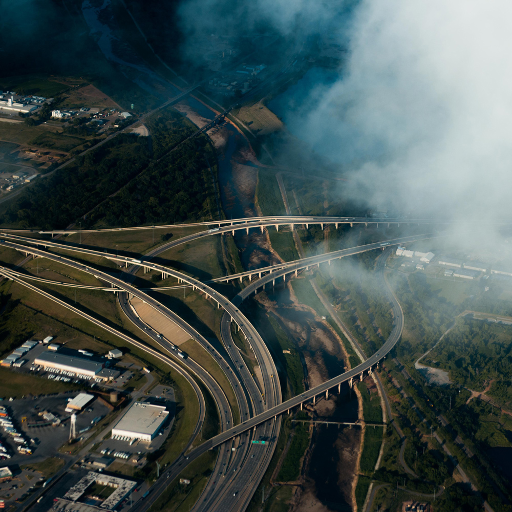
Mobile mapping & geophysical services

Field offers diverse mobile mapping and geophysical services for the public and private sectors. With laser scanners mounted on a car, we can acquire millions of points per second. This very detailed point cloud is used for creating 3D vector models and is a basis for producing a TIN-model for advanced applications. At the same time with scanning, images and video can be captured. The images are 360-degree street view imagery that can be accessed and used in a separate web viewer, Mapspace. We can also collect information about road conditions and map utilities, groundwater, and bedrock using many geophysical methods and tools.
Mapping & modelling

We offer a broad set of geospatial mapping and data services such as urban and corridor mapping services, remote-sensing based forest inventory and location-based services. We are living in a digital world, where digital model of physical assets is the standard. Design, construction and maintenance are done in 3D, which saves costs and increases efficiency. We have extensive experience in processing geospatial data into 3D models of cities, infrastructure, buildings, terrain, and seabed.
Software

We offer a suite of software products that bring value to customers and partners across the world. Our cloud-based software products help our clients easily access and use their data. Mapspace provides the opportunity to use orthophotos, oblique images, street views (360-degree images) and point clouds for various mapping and analysis purposes. Atlas is an advanced yet simple field survey tool. Our software products support external data sources like WMS/WMTS or local vector data to empower you accurately and provide valuable insights online.


Coastal
Data and insights needed to build and maintain a better tomorrow.
Oceans, rivers and lakes are very important for both our climate and economy. Surveying and mapping are the foundation of our knowledge about these water bodies. We are specialised in surveying water depths and coastal lines using state-of-the-art airborne bathymetric LiDAR technology. This is the fastest, most accurate and cost-effective technology available for the mapping of shallow water areas.
Capabilities
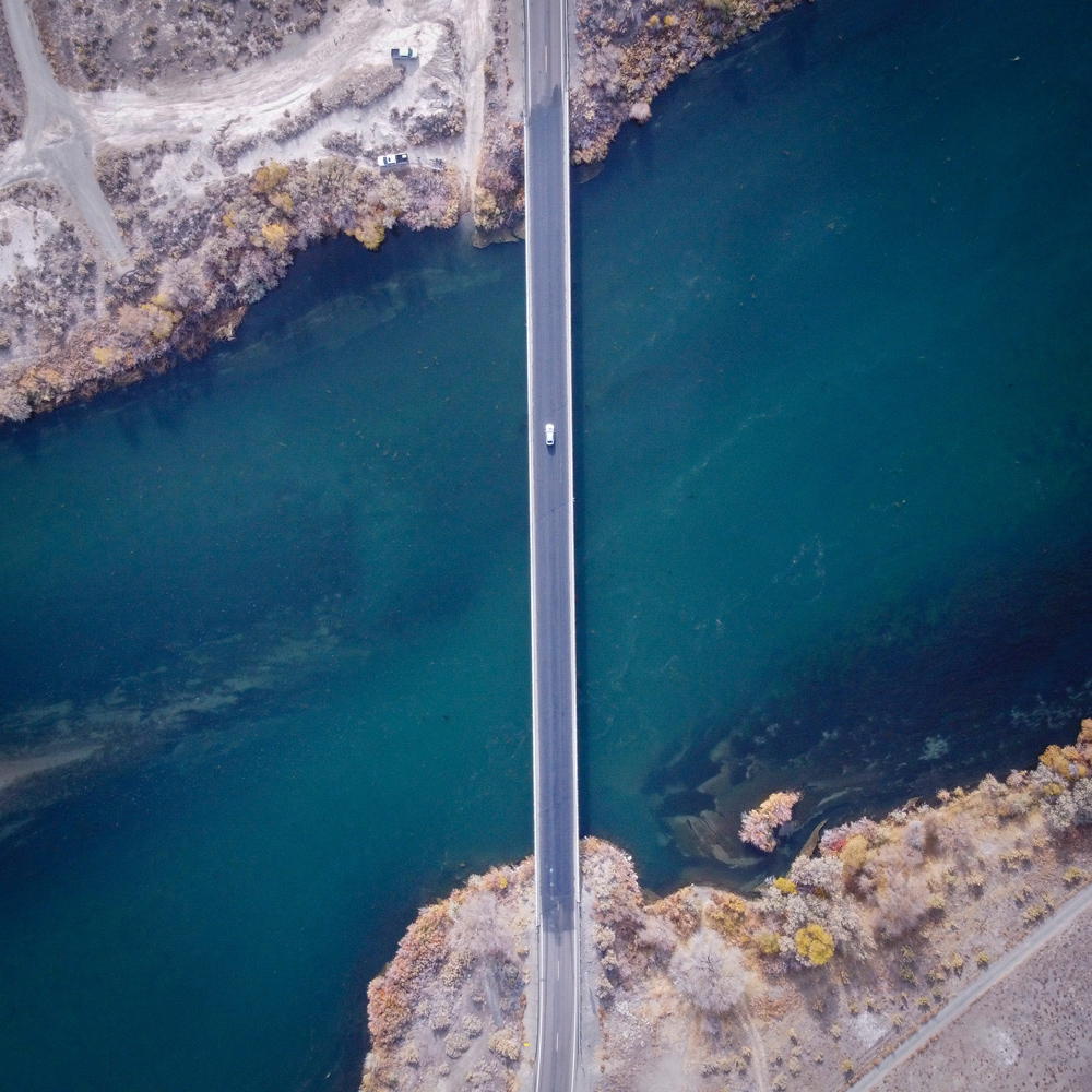
Land surveying

Land surveying plays an important role in the planning and execution phase for most infrastructure and construction projects around the world. The technique determines the accurate geographical three-dimensional position of points and the distances and angles between them. Land surveying ensures the accuracy between digital models and the physical world.
Mobile mapping & geophysical services
Field offers diverse mobile mapping and geophysical services for the public and private sectors. With laser scanners mounted on a car, we can acquire millions of points per second. This very detailed point cloud is used for creating 3D vector models and is a basis for producing a TIN-model for advanced applications. At the same time with scanning, images and video can be captured. The images are 360-degree street view imagery that can be accessed and used in a separate web viewer, Mapspace. We can also collect information about road conditions and map utilities, groundwater, and bedrock using many geophysical methods and tools.
Mapping & modelling
We offer a broad set of geospatial mapping and data services such as urban and corridor mapping services, remote-sensing based forest inventory and location-based services. We are living in a digital world, where digital model of physical assets is the standard. Design, construction and maintenance are done in 3D, which saves costs and increases efficiency. We have extensive experience in processing geospatial data into 3D models of cities, infrastructure, buildings, terrain, and seabed.
Land and property consultancy

Field’s land and property specialists provide cadaster, land acquisition and building application services. Our customers are mostly government departments and municipalities and property developers. We have a highly skilled team ready to help with land and property services in Norway.
Software
We offer a suite of software products that bring value to customers and partners across the world. Our cloud-based software products help our clients easily access and use their data. Mapspace provides the opportunity to use orthophotos, oblique images, street views (360-degree images) and point clouds for various mapping and analysis purposes. Atlas is an advanced yet simple field survey tool. Our software products support external data sources like WMS/WMTS or local vector data to empower you accurately and provide valuable insights online.
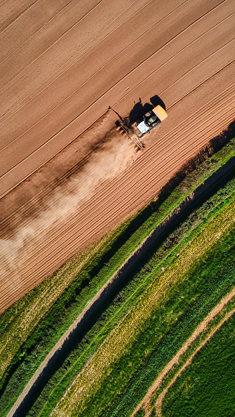
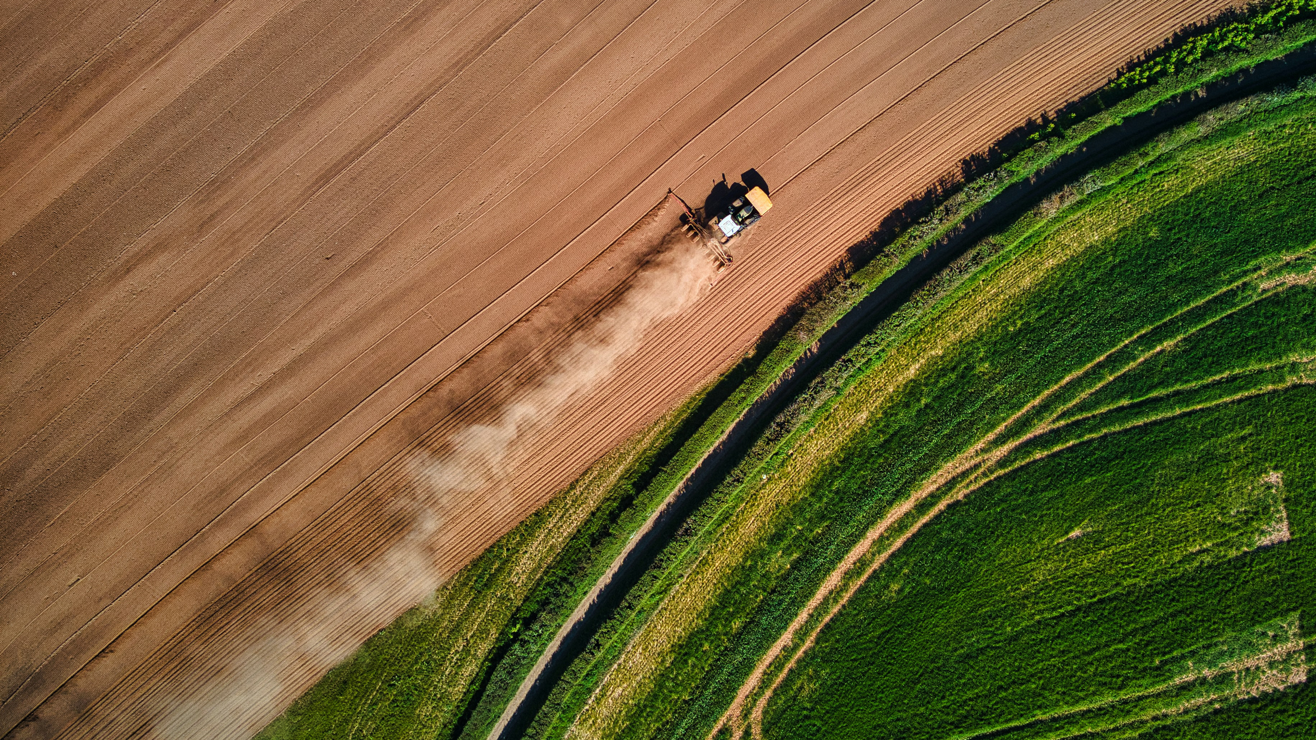
Agriculture
Data and insights needed to build and maintain a better tomorrow.
In agriculture, geospatial technologies are helping farmers to achieve increased production and reduced costs by enabling better and more sustainable management of their resources. With our advanced remote-sensing technologies we help farmers to improve their decision-making capabilities for planning their cultivation to maximize yields.
Capabilities
Land surveying
Land surveying plays an important role in the planning and execution phase for most infrastructure and construction projects around the world. The technique determines the accurate geographical three-dimensional position of points and the distances and angles between them. Land surveying ensures the accuracy between digital models and the physical world.
Mobile mapping & geophysical services
Field offers diverse mobile mapping and geophysical services for the public and private sectors. With laser scanners mounted on a car, we can acquire millions of points per second. This very detailed point cloud is used for creating 3D vector models and is a basis for producing a TIN-model for advanced applications. At the same time with scanning, images and video can be captured. The images are 360-degree street view imagery that can be accessed and used in a separate web viewer, Mapspace. We can also collect information about road conditions and map utilities, groundwater, and bedrock using many geophysical methods and tools.
Mapping & modelling
We offer a broad set of geospatial mapping and data services such as urban and corridor mapping services, remote-sensing based forest inventory and location-based services. We are living in a digital world, where digital model of physical assets is the standard. Design, construction and maintenance are done in 3D, which saves costs and increases efficiency. We have extensive experience in processing geospatial data into 3D models of cities, infrastructure, buildings, terrain, and seabed.
Land and property consultancy
Field’s land and property specialists provide cadaster, land acquisition and building application services. Our customers are mostly government departments and municipalities and property developers. We have a highly skilled team ready to help with land and property services in Norway.
Software
We offer a suite of software products that bring value to customers and partners across the world. Our cloud-based software products help our clients easily access and use their data. Mapspace provides the opportunity to use orthophotos, oblique images, street views (360-degree images) and point clouds for various mapping and analysis purposes. Atlas is an advanced yet simple field survey tool. Our software products support external data sources like WMS/WMTS or local vector data to empower you accurately and provide valuable insights online.
Related cases
Buildings & properties
A digital twin of one of Norway's largest industrial estates
-Mo Industripark

Buildings & properties
A digital twin of one of Norway's largest industrial estates
-Mo Industripark
Explore other areas
Construction & infrastructure
Urban & government
We’re here to answer your questions
Contact us to discuss how we can help you and your organization plan, build and manage safe and efficient natural and built environments.