Services
Electric resistivity tomography
Knowledge about bedrock depth and bedrock topography is essential to any construction or infrastructure project. Mapping the subsurface resistivity can be used to identify bedrock and identify aquifers, groundwater levels, and water leaks.
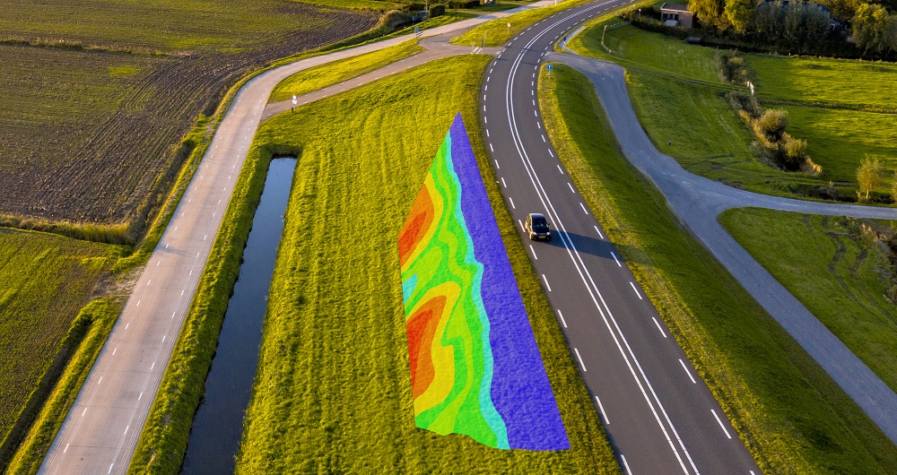
All electrical resistivity methods involve sending an electric current into the ground and measuring the resistance at various locations and distances along a profile. 1D or 2D inversion converts resistance values into resistivity profiles that can be interpreted.
The equipment our specialists use can additionally measure chargeability during the same measurement cycle and provide additional information that can be used to distinguish materials such as clay from water, for example.
Combining ERT with other geophysical methods, such as GPR or refraction seismics, will provide a more comprehensive picture of the subsurface.
Get in touch
Norway
Tobias Jokisch
+47 902 09 686
tobias.jokisch@field.group
Mobile Mapping & Geophysics
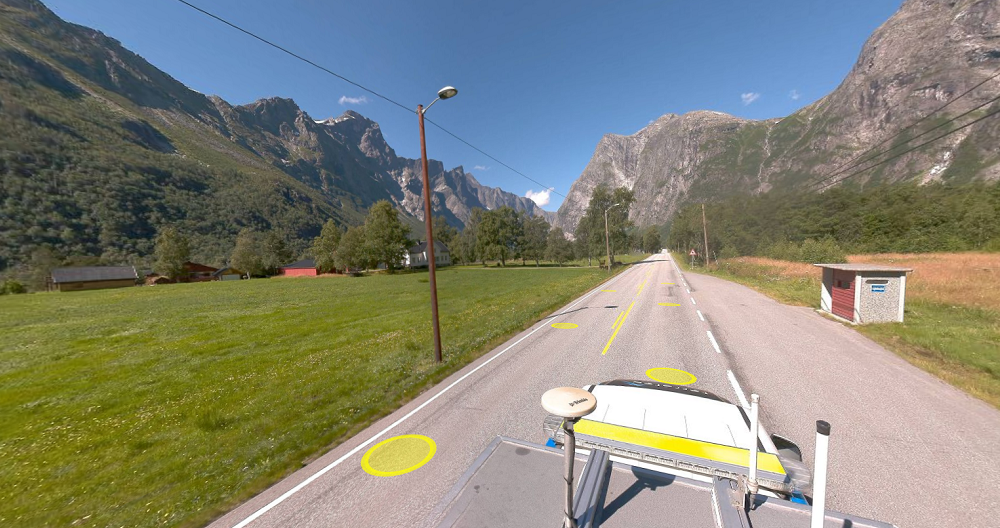
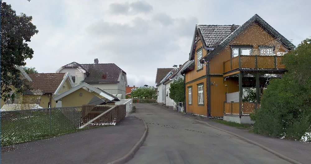
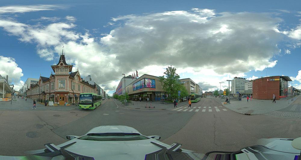
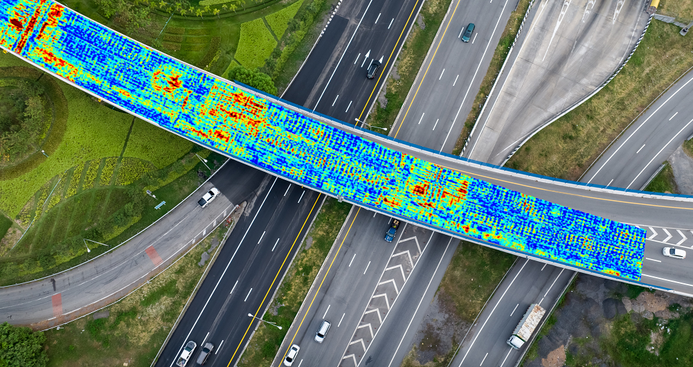
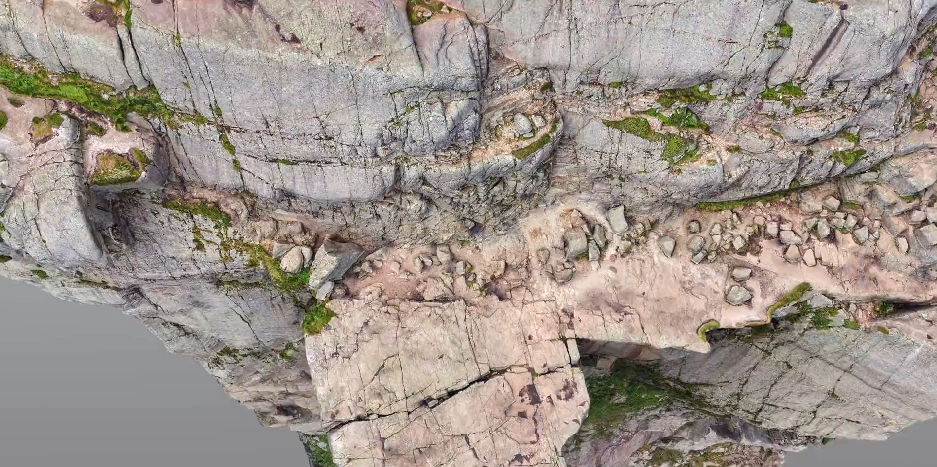
With laser scanners mounted on a car, we can acquire millions of points per second. This very detailed point cloud is used for creating 3D vector models and it is a basis for producing a TIN-model for advanced applications. At the same time with scanning, images and video can be captured. The images are 360-degree street view imagery that can be accessed and used in a separate web viewer, Mapspace. We can also collect information about road conditions and map utilities, groundwater and bedrock using ground penetrating radar. Explore more Field Mobile Mapping & Geophysical Services below.
Geospatial solutions powered by software, sensors, and AI technologies
Join us and help capture and transform accurate geospatial data into valuable insights and digital twins.